Free and Open Source

QGIS Feed
Explore the latest updates, news, and resources for the QGIS community.

Explore the latest updates, news, and resources for the QGIS community.
You can also access the QGIS News Feed in JSON format.
Save the date! The next global QGIS User Conference will be in Norrköping, Sweden from 2-3 June, 2025. Our contributor meeting will be directly afterwards from 4 to 6 June, 2025.
QGIS User Conference and Contributor meetings are the best place to engage with the community, keep up with the latest QGIS related news, and find your own path to contributing to the QGIS project.
Double click on this entry to find out more!

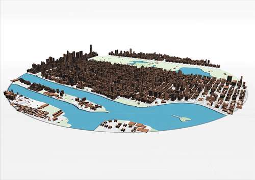
This crowdfunding campaign will improve and extend QGIS 3D capabilities, making it an ideal platform for digital twins. The project aims to add support for ESRI Scene Layers (I3S), support for more point cloud algorithms and enhanced vector support in 3D.
We’re migrating to Qt6 and launching QGIS 4.0 in October 2025!
Expect modern libraries with performance and security improvements, a smooth transition for plugin devs, and a few pleasant surprises. Double-click this article for details!
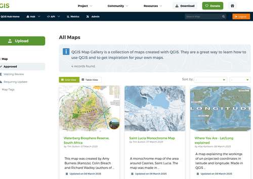
QGIS has a new map gallery! We are looking for submissions of beautiful maps made using QGIS. The maps will be displayed on the main web site at https://qgis.org if approved. Our goal is to show off the power and versatility of QGIS to the world. If you have a great map to share, double click this article to visit the gallery and start sharing your submissions!
Ready for this month's QGIS open day? Join us on friday to catch up on what has been happening in the QGIS community! Double click on this entry to see how to attend remotely, or offer a talk...
Friday is QGIS Open Day! Join this monthly virtual event showcasing the latest happenings in QGIS. Participation is free. This month's line up:
- Downloading Climate R - Terraclimate datasets within QGIS
- An end to end workflow with QGIS, Mergin Maps and GeoNode
- Exploring the possibilities of QField plugin framework
- QGIS 3.42 Release Party
Double click this article to see more details (including how to offer a talk yourself).
Maintenance notice: On 10 February 2025 at 10h00 UTC we will be performing scheduled maintenance to upgrade the plugins web server. During this update, following services may be temporarily disrupted:
- Installing plugins via the QGIS plugin manager
- Viewing / uploading / managing plugins on plugins.qgis.org
- Accessing the hub resources
- Access to plugins-analytics.qgis.org
Thank you for your patience
We're running a short, anonymous QGIS Documentation User Survey to gather feedback and improve our manuals, guides, and resources. Whether you're a beginner or an experienced user, your input will help us make the documentation better for everyone. The survey will remain open until December 20th.
Please take a moment to share your thoughts!
Take the survey by double-clicking this entry.
Thank you for your time and support!
The Cyber Resilience Act will, by design, place considerable strain on the Open Source Geospatial Foundation and the service providers who power so much of our ecosystem. The OSGeo community has been active during this process lending their voice of concern, feedback, and moral objection (not everything is a product!) and support. We encourage you to get informed and lend your voice of support to ensure that these laws do not jeopardise or impact projects like QGIS. Double-click this entry to learn more.

OpenStreetMap (OSM) is free to use, but not free to run. The QGIS user experience is tremendously improved thanks to OSM data, tiles, geocoding, and other services. OSM depends on donations from people like you! Double-click this entry to learn how to support OSM's continued stability, quality, and independence.


Flagship membership

Flagship membership

Flagship membership

Large membership

Large membership

Large membership

Large membership

Large membership

Large membership

Large membership

Large membership

Large membership