Free and Open Source
QGIS Feed
Explore the latest updates, news, and resources for the QGIS community.
Explore the latest updates, news, and resources for the QGIS community.
You can also access the QGIS News Feed in JSON format.
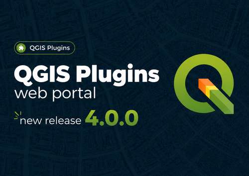
A planned update to the plugins.qgis.org website is coming on 13 July 2026. The version v4.0.0 will include major improvements and changes related to the security checks and plugins auto-approval; and a new feature for Qt6 compatibility check. Plugin developers can preview the planned changes now to confirm nothing affects publishing.
Read the full preview and details on our blog post. Thank you for being part of the QGIS community.
QGIS installers previously included all PROJ reprojection grids—large TIFF files totaling up to 800 MB, making the full package 1.3 GB. This caused issues for users and high server bandwidth.
Future installers will exclude these grids. QGIS can download missing grids on demand, while full offline installers remain available for those needing offline deployment.
We are looking for an administrative assistant to help us amplify our impact! The QGIS project is largely managed by volunteers who are experiencing increasing administrative workloads as the project grows. To address this, we want to hire an administrative assistant to support our work. Is that something that interests you or someone you know? See our blog for more details!
Last call! The QGIS UC2026 Call for Papers closes April 12 at 23:59 (Europe/Zurich). We're looking for talks, workshops, and mini-workshops – all levels welcome, from end users to developers, academia to industry.
Don't miss your chance to present at Laax this October, submit now!
The 2026 QGIS User Conference is coming to Laax, Switzerland, and we'd love your support!
For the first time, our annual QGIS Conference will be held in the Swiss Alps. This community-driven event brings together QGIS users, developers, and contributors from around the world. If your organisation benefits from QGIS and wants to give back, sponsoring the UC is a great way to do it.
Have a look at our sponsorship brochure for more detail.
QGIS 4.0 is out and we're raising funds to support what comes next. This year we're aiming to grow sustaining membership income by €100,000 to fund more bug fixing, faster pull request reviews, a project secretary for the PSC, expanded security work, and a larger grants programme.
Memberships start at €500/year. Every new member counts.
The Call for Papers for the 2026 QGIS User Conference is now open! We welcome talks and workshops of all levels, from end users to developers, from academia to industry. Topics can include QGIS use cases, new features, ecosystem tools, and more. Submit your proposal by 12 April 2026 at 23:59 (Europe/Zurich). See you in Laax! 🏔️
Double click here for more information
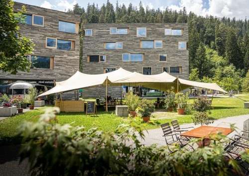
We’ve just added conference rates to the recommended accommodation options in Laax!
Joining for the conference, the contributor meeting, or both? You can now start planning your stay using the booking links on the conference website. Conference rates are valid 2–11 October 2026.
Looking forward to bringing the QGIS community together in the Swiss Alps - see you in LAAX!
Double-click this entry for more info!
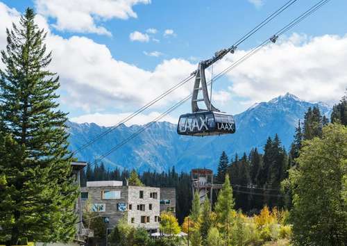
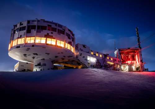
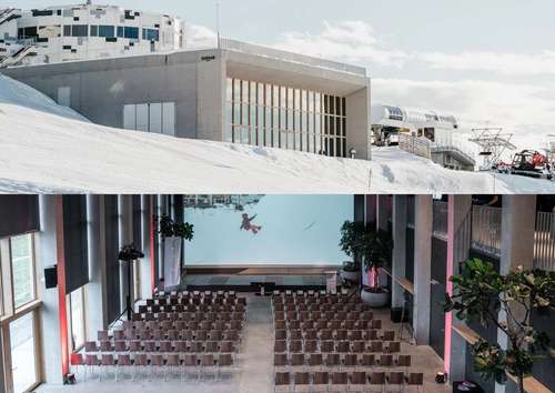
The QGIS User Conference 2026 location is now official! We’re heading to Laax, Switzerland in the heart of the Swiss Alps, where QField was born.
Join us on 5–6 October 2026 at Crap Sogn Gion (2,222 m) for two days of talks, workshops, and community, surrounded by spectacular mountain scenery and outdoor adventures.
Double-click to visit the conference page
The QGIS User Conference 2026 will take place in early October in Switzerland
4 October – Informal active outdoor pre-event
5–7 October – Conference and workshops
7–9 (10) October – Contributors Meeting
Double-click this entry to view the full blog post

Flagship membership

Flagship membership

Flagship membership

Large membership

Large membership

Large membership

Large membership

Large membership

Large membership

Large membership

Large membership

Large membership